


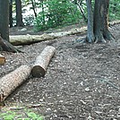

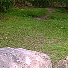
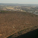
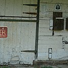
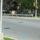
 Description for Hemlock Springs, 2011 June

Description by GoldenBear

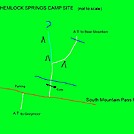
Sketch map of Hemlock Springs Camp. White line is AT, dark blue lines are streams with water, light blue is path going to ?, brown line is dirt road, and triangles are campsites
-
#1
Re: Hemlock Springs, 2011 June
I created this sketch to assist later visitors to this campground. It is most definitely NOT to scale, and is meant for directional advice only.
The white line is the A.T., the brown line is South Mountain Pass Road, the dark blue lines are flowing water, and the light blue line is a path going somewhere I didn't bother to find out. It is NOT the trail to Anthony's Nose; that blue-blazed trail is about half a mile closer to the Bear Mountain Bridge. Camp sites, many of which are included in this photo set, are marked with black triangles.


Comments for Hemlock Springs, 2011 June (1)