


 Description for A.T. Ascent Of Center Point Knob, PA, 10/06/12

Description by Irish Eddy

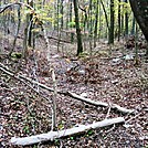
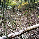
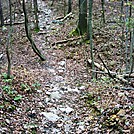
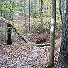
For northbounders, north of the Monroe - South Middleton Township boundary marker, the A.T. makes a gradual descent to approximately 850 feet elevation, crosses a gulley, and then begins an ascent of Center Point Knob. This is a view of the trail looking north toward the gulley, a dry stream bed that feeds into Little Dogwood Run to the west. SoBo 1070.4 NoBo 1108.7


Comments for A.T. Ascent Of Center Point Knob, PA, 10/06/12 (0)