


 Description for A. T. Ascent To Raven Rock, Md, 06/06/09

Description by Irish Eddy

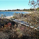
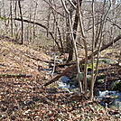
For northbounders, from Raven Rock Road, MD Route 491, the A. T. begins a 600 foot ascent from approximately 1060 feet elevation to 1660 feet elevation. There are several switchbacks, and at times the climb can be steep, but there are several interesting rock formations, and at least one great vantage point. This is a view of the A.T. looking north from a location approximately 0.4 mile north of Raven Rock Road, MD Route 491. Note the double blue blaze on the tree in the upper center. This is a short access trail to a large rock outcropping which offers an excellent view. This outcropping is commonly referred to as "Raven Rock," although the USGS refers to the entire mountain as Raven Rock. SoBo 1129.4. NoBo 1048.9.


Comments for A. T. Ascent To Raven Rock, Md, 06/06/09 (0)