


 Description for A. T. North Of Deer Lick Run, P A, 01/16/10

Description by Irish Eddy

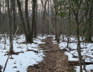
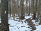
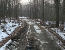
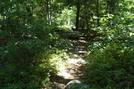
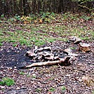
For approximately 1.1 miles north of the pipeline crossing, the A.T. makes a gradual descent from approximately 1470 feet elevation to less than 900 feet elevation as it approachs the Antietam Creek East Branch. Approximately 0.2 mile north of the pipeline crossing the A.T. intersects an unidentified dirt road which connects Old Forge Road to the west of the trail with Rattlesnake Road to the east of the trail. This is view from the A.T. looking east from the intersection with the unidentified road. SoBo 1117.9 NoBo 1061.2.


Comments for A. T. North Of Deer Lick Run, P A, 01/16/10 (0)