


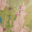
 Description for Map of area near High Road

Description by GoldenBear

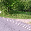
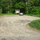
This is the map at the parking lot, which is a little misleading. The A.T. does not quite reach this parking lot, but instead goes right along High Road & FS 19. Also, Jeffers Brook Shelter is MUCH closer to FS 19 than this map would suggest.


Comments for Map of area near High Road (0)