


 Description for A. T. North Of High Rock, Md, 06/06/09

Description by Irish Eddy

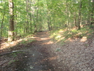
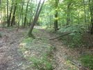
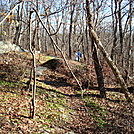
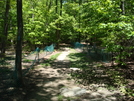
North of High Rock, after a steep, rocky descent of almost 600 feet from approximately 1830 feet elevation to 1250 feet elevation along the southwest slope of Quirauk Mountain, the A.T. levels out somewhat and continues north . At times the trail follows the bed of an old railroad line which used to service Pen Mar Park in its heyday as a popular amusement park. This is a view of the A.T. looking north from a location approximately 2.6 miles north of the High Rock access trail. SoBo 1124.4. NoBo 1053.9.


Comments for A. T. North Of High Rock, Md, 06/06/09 (0)