


 Description for A.T. North of Lisburn Road, PA Rte. 2004, PA, 07/27/13

Description by Irish Eddy

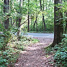
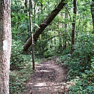
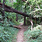
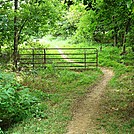
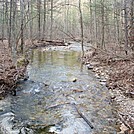
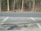
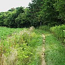
For northbounders, north of the Lisburn Road, PA Rte. 2004, crossing in the Cumberland Valley, the A.T. continues to follow a geographical feature, referred to on topographical maps as Stoney Ridge. Elevation changes are gradual and vary between approximately 450 and 575 feet. It is not uncommon to see joggers using this section of the trail. This is a view of the trail looking south from a location approximately 0.3 north of the Lisburn Road, PA Rte. 2004 crossing.


Comments for A.T. North of Lisburn Road, PA Rte. 2004, PA, 07/27/13 (0)