


 Description for Google Map Streetviews Of The At

Description by Magic Man

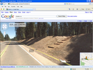
Photo shows a double-blaze
where the trail meets highway 220 near Daleville, VA.
 Description for Google Map Streetviews Of The At
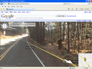
Photo shows a double-blaze
where the trail meets highway 220 near Daleville, VA.
 Image Code
More Images by Magic Man
Image Code
More Images by Magic Man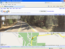


 Share this Page


Comments for Google Map Streetviews Of The At (0)