


 Description for A. T. North Of High Rock, Md, 06/06/09

Description by Irish Eddy

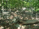
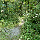
North of High Rock, the A. T. begins a steep, rocky descent almost 600 feet from approximately 1830 feet elevation to 1250 feet elevation along the southwest slope of Quirauk Mountain. There are several switchbacks on the descent. It seemed to me that there are more white blazes for southbounders than for northbounders, so look behind you if you think you have lost the trail. This is of the A.T. looking south from a location approximately 1.0 mile north of the High Rock access trail. Tenderfoot Dave making his way down Quirauk Mountain. SoBo 1126.5. NoBo 1051.8.


Comments for A. T. North Of High Rock, Md, 06/06/09 (0)