


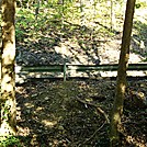

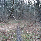
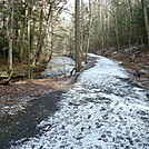
 Description for A.T. At Conodoguinet Creek, Cumberland Valley, PA, 09/27/13

Description by Irish Eddy

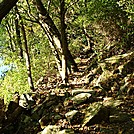
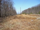
For approximately 0.5 mile south of the Conodoguinet Creek crossing, the A.T. runs parallel to the western slope of a steep ridge with Conodoguinet Creek to the west and below the trail, and Bernehisel Bridge Road to the east and above the trail. This is a view from the trail looking west toward Conodoguinet Creek from a location approximately 0.3 mile south of the Conodoguinet Creek crossing.


Comments for A.T. At Conodoguinet Creek, Cumberland Valley, PA, 09/27/13 (0)