


 Description for A.T. Crosing At Trindle Road, PA Rte. 641, PA, 07/27/13

Description by Irish Eddy

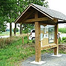
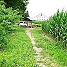
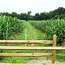
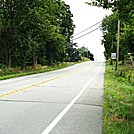
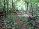
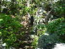
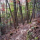
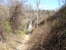
For northbounders,approximately 0.4 mile north of the Boyer Road crossing, the A.T. emerges from a wooded area, skirts the edge of a soybean field, and then descends the western slope of Stoney Ridge before crossing Trindle Road, PA Rte. 641, in the Cumberland Valley. This is a view of the trail looking north from Trindle Road, PA Rte. 641. Note the blue blazes for the side trail leading to the A.T. parking area, located approximately 0.1 mile west of the trail.


Comments for A.T. Crosing At Trindle Road, PA Rte. 641, PA, 07/27/13 (0)