- Connecticut Shelters (https://whiteblaze.net/forum/vbg/browseimages.php?c=569)
- - Riga Lean-to: map of Riga camping area (https://whiteblaze.net/forum/vbg/showimage.php?i=13155&c=569)
Riga Lean-to: map of Riga camping area
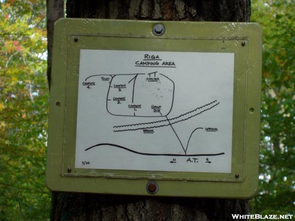 Capacity: 8, Fee: No, Reliable Water: Yes, Privy: Yes, Camping: Yes
The town of Salisbury, Litchfield County, Connecticut
Elevation: 1610'
685.7 miles to Katahdin and 1488.9 miles from Springer
Next shelter north 1.2 miles. Brassie Brook Lean-to
Next shelter south 8.0 miles. Limestone Spring Lean-to
Maintained by: AMC - Connecticut Chapter
USGS quad: ASHLEY FALLS
The town of Salisbury, Litchfield County, Connecticut
Elevation: 1610'
685.7 miles to Katahdin and 1488.9 miles from Springer
Next shelter north 1.2 miles. Brassie Brook Lean-to
Next shelter south 8.0 miles. Limestone Spring Lean-to
Maintained by: AMC - Connecticut Chapter
USGS quad: ASHLEY FALLS
All times are GMT -4. The time now is 09:58.
Powered by WhiteBlaze Gallery v3.01
Powered by Appalachian Trail Enthusiasts
Powered by WhiteBlaze Gallery v3.01
Powered by Appalachian Trail Enthusiasts