WhiteBlaze Pages 2024
A Complete Appalachian Trail Guidebook.
AVAILABLE NOW. $4 for interactive PDF(smartphone version)
Read more here WhiteBlaze Pages Store

Page 1 of 2 1 2 LastLast
Results 1 to 20 of 32
  1. #1
    First Sergeant SGT Rock's Avatar
    Join Date
    09-03-2002
    Location
    Maryville, TN
    Age
    57
    Posts
    14,861
    Images
    248

    Default BMT Northern Terminus Officially Changed

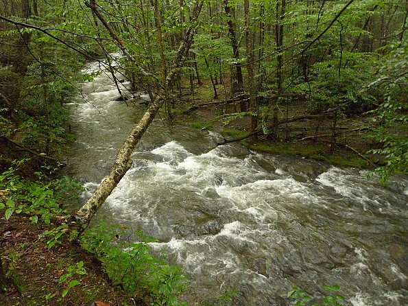
    This year the BMTA voted to change the northern terminus of the BMT to the bridge over Big Creek at the Big Creek recreation area and the start of the Baxter Creek Trail. They did this based on feedback from thru-hikers that felt that this is really where the "trail" ended. The new recommended route to connect the BMT with the AT is the Chestnut Branch Trail. The 2012 Databook, my guide, and the up coming Smokies section guide for the BMT will all reflect the change.
    Last edited by SGT Rock; 11-07-2011 at 20:22.
    SGT Rock
    http://hikinghq.net

    My 2008 Trail Journal of the BMT/AT

    BMT Thru-Hikers' Guide
    -----------------------------------------

    NO SNIVELING

  2. #2
    PCT, Sheltowee, Pinhoti, LT , BMT, AT, SHT, CDT, TRT 10-K's Avatar
    Join Date
    10-30-2007
    Location
    Erwin, TN
    Age
    62
    Posts
    8,492

    Default

    Excellent, I think that's a good decision.

  3. #3
    PCT, Sheltowee, Pinhoti, LT , BMT, AT, SHT, CDT, TRT 10-K's Avatar
    Join Date
    10-30-2007
    Location
    Erwin, TN
    Age
    62
    Posts
    8,492

    Default

    Now if they'd string a rope over Slickrock Creek ...

  4. #4

    Default

    To bad they didn't vote on getting some high-water alternatives in place for the creeks in the wilderness area/proposed wilderness area. That's the type of information that thru-hikers could really benefit from. (Though having the option and still count the trial as complete is nice....)

  5. #5
    First Sergeant SGT Rock's Avatar
    Join Date
    09-03-2002
    Location
    Maryville, TN
    Age
    57
    Posts
    14,861
    Images
    248

    Default

    Quote Originally Posted by 10-K View Post
    Now if they'd string a rope over Slickrock Creek ...
    LOL, can't. Wilderness area.

    Quote Originally Posted by Bati View Post
    To bad they didn't vote on getting some high-water alternatives in place for the creeks in the wilderness area/proposed wilderness area. That's the type of information that thru-hikers could really benefit from. (Though having the option and still count the trial as complete is nice....)
    Well any trail that would allow one to go around it would be authorized in the eyes of the BMTA, they don't stand too much on all the purism that some folks get wrapped up in around the AT. A map of the trails in the wilderness is about all one would need for that.
    SGT Rock
    http://hikinghq.net

    My 2008 Trail Journal of the BMT/AT

    BMT Thru-Hikers' Guide
    -----------------------------------------

    NO SNIVELING

  6. #6
    PCT, Sheltowee, Pinhoti, LT , BMT, AT, SHT, CDT, TRT 10-K's Avatar
    Join Date
    10-30-2007
    Location
    Erwin, TN
    Age
    62
    Posts
    8,492

    Default

    Quote Originally Posted by SGT Rock View Post
    LOL, can't. Wilderness area.
    Don't get me wrong, I'm not trying to sanitize the outdoors and make the BMT handicap accessible but that's a rather dangerous crossing. You don't think the powers that be would make an exception to a 40' piece of 1" rope strung between 2 trees in the interest of safety.

    Maybe I just caught it on a rough day but I came very close to losing it there and if memory serves a day or 2 before I crossed a guy did get swept downstream but fortunately was hiking with somebody who pulled him out and got him into some dry clothes quick (it was cold....).

    I wonder if anyone has ever bushwhacked up and down the creek a ways from the trail to see if there is an easier / safer place to cross?

  7. #7

    Default

    Quote Originally Posted by 10-K View Post
    Now if they'd string a rope over Slickrock Creek ...
    Quote Originally Posted by 10-K View Post
    Don't get me wrong, I'm not trying to sanitize the outdoors and make the BMT handicap accessible but that's a rather dangerous crossing. You don't think the powers that be would make an exception to a 40' piece of 1" rope strung between 2 trees in the interest of safety.

    Maybe I just caught it on a rough day but I came very close to losing it there and if memory serves a day or 2 before I crossed a guy did get swept downstream but fortunately was hiking with somebody who pulled him out and got him into some dry clothes quick (it was cold....).

    I wonder if anyone has ever bushwhacked up and down the creek a ways from the trail to see if there is an easier / safer place to cross?
    First off, that one crossing on Slickrock Creek is only dangerous a couple times of year, or just after a hard rain, in which case the prudent backpacker would set up camp near the Stiffknee jct where there's a fine campsite and sit it out. What's the hurry? I remember the time Sgt Rock crossed over on an old blowdown pine in the creek, but that has since been washed away.

    I had a rough winter crossing there a couple years ago and had to go downstream about 75 feet where I found a much better place to cross. If a person goes upstream from the crossing to the next crossing past the Stiffknee jct, he'll see a big boulder washed down the creek in a previous flood and placed right on top of a level washboard set of rocks at the creek's surface. Neato. It looked to be about a 1,000 lbs.

    My idea all along is to have a suitable and authorized blue blazed BMT trail running from Beech Gap to Cold Spring Gap and then---
    ** Going up 54A to Bob Bald and
    ** Along the ridge to Naked Ground and the Hangover,
    ** Then down Hangover Lead South to Big Fat Gap where two choices are available:

    1) Big Fat to Windy Gap on the Windy Gap trail and then down the Nichols Cove trail to the Yellowhammer and connect to Ike Branch and out. Or
    2) Down Big Fat Gap trail to Slickrock Creek and a no-crossing trek up Nichols Cove trail to Yellowhammer and Ike and out.

    This long involved and further route would show BMT backpackers the open bald on the Bob and the fantastic overlook on the Hangover. Of course, it would miss the almost equally nice Fodderstack Ridge hump and the awesome Stiffknee trail and Little Slickrock Creek valley trek.

  8. #8
    PCT, Sheltowee, Pinhoti, LT , BMT, AT, SHT, CDT, TRT 10-K's Avatar
    Join Date
    10-30-2007
    Location
    Erwin, TN
    Age
    62
    Posts
    8,492

    Default

    When I crossed Slickrock Creek it had rained a couple of inches within the previous 48 hours. When I saw the crossing my first thought was something like "Holy mother of God..."

    Had I not whacked my leg and had to hole up at Richard Harris's house for almost a day I would have definitely been sitting there waiting for the creek to go down because I can't imagine crossing it.

    I don't smoke cigarettes in my "real life" but when I'm hiking I always carry a pack and if things start getting out of hand or if I run into a problem or stressor my #1 rule is to sit down, take off my pack, lean against a tree and have a smoke and clear my mind. When I got across Slickrock Creek I stopped and had a smoke...

  9. #9

    Default

    Quote Originally Posted by 10-K View Post
    When I crossed Slickrock Creek it had rained a couple of inches within the previous 48 hours. When I saw the crossing my first thought was something like "Holy mother of God..."

    Had I not whacked my leg and had to hole up at Richard Harris's house for almost a day I would have definitely been sitting there waiting for the creek to go down because I can't imagine crossing it.

    I don't smoke cigarettes in my "real life" but when I'm hiking I always carry a pack and if things start getting out of hand or if I run into a problem or stressor my #1 rule is to sit down, take off my pack, lean against a tree and have a smoke and clear my mind. When I got across Slickrock Creek I stopped and had a smoke...
    I do the same thing but instead of a cigarette I pull out a probar and contemplate weeping but instead I set up the tent and figure I may be there for two days or four days or once for a week.


    I was out camping on Slickrock Creek during Tropical Storm Lee (recently) and here's what it looked like the morning after. And of course, everyone associated with Slickrock should watch this video posted on Youtube by gsindall: (The pertinent wisdom here is---he's not wearing a 60 lb pack!). And it's not in February!


  10. #10
    PCT, Sheltowee, Pinhoti, LT , BMT, AT, SHT, CDT, TRT 10-K's Avatar
    Join Date
    10-30-2007
    Location
    Erwin, TN
    Age
    62
    Posts
    8,492

    Default

    That's an amazing video.... when I crossed it was just above crotch deep. Really the biggest problem is that I couldn't see the bottom - that was what was so unnerving. I could see enough to know approximately how deep it was but it was too murky to make out where to put my feet. And the current was strong so there wasn't a lot of time to stay stationary because you know when you stand still in swift flowing water you only have a little window of time before the current wins.

    I was just glad to get across. Definitely something I won't forget.

    Wonder what people do with dogs there?

  11. #11

    Default

    Here's a picture of Whiteblazer Wisenbur crossing the Slickrock at that particular spot:


    More could be said about his german pack than about the crossing . . . . . (Fotog courtesy of Hootyhoo).


    Here's another Whiteblazer named Medicine Man crossing at the same spot but in much lower water.

    Finally---yes, I once risked my life on a nasty swollen river---the Upper Bald after four days of rain---and like an idiot I decided to go for it. Near fatal mistake. I had an enormous pack, a hiking pole in my left hand and my dog by his dog pack in my right hand. Midway thru the tumult and roaring tons of water I almost lost my footing when my dog slammed against my right hip by the current and I flung him forward about 10 feet using adrenaline. We survived. The below pictures show the Bald River in normal flow and then shows the day I crossed it (of course I was a couple miles upstream from where this picture was taken).


    Read it and weep.

  12. #12
    PCT, Sheltowee, Pinhoti, LT , BMT, AT, SHT, CDT, TRT 10-K's Avatar
    Join Date
    10-30-2007
    Location
    Erwin, TN
    Age
    62
    Posts
    8,492

    Default

    Oh well... I can see what you're saying about not needing a rope.... I think the first Noland Creek crossing was deeper/rougher than those pictures of Slickrock. So I definitely caught it on a bad day.

    It's good to see a picture of what Slickrock normally looks like for future reference. Now I know what I can expect if I have to sit it out and wait. Because I will hike the BMT again, for sure.....

  13. #13
    Getting out as much as I can..which is never enough. :) Mags's Avatar
    Join Date
    03-15-2004
    Location
    Colorado Plateau
    Age
    49
    Posts
    11,002

    Default

    Thanks for posting the photos. That was one of my favorites areas of the BMT.... Beautiful area.
    Paul "Mags" Magnanti
    http://pmags.com
    Twitter: @pmagsco
    Facebook: pmagsblog

    The true harvest of my life is intangible...a little stardust caught,a portion of the rainbow I have clutched -Thoreau

  14. #14

    Default

    Quote Originally Posted by Mags View Post
    Thanks for posting the photos. That was one of my favorites areas of the BMT.... Beautiful area.
    It's sort of a stretch of unbroken "wilderness" from Beech Gap all the way to Hiway 129 and Calderwood Lake. I consider the Slickrock to be the cleanest river in the Southeast and it's probably why I keep returning.

  15. #15

    Default

    If there's a better place to cross 75 down from the little island where the sign is, then the BMTA could easily move the sign down to the better fording site. That's the sort of change that will help much more than dumping a short roadwalk. In addition, they could try to post a "water-danger level" mark on a signpost to help in warning hikers. Something like "typically if this isn't an island, you're fine, but if it is due to high water, you might want to hang around and cross some other day". Ditto on trying to get the park to change reservation and permit rules for BMT hikers to encourage waiting around instead of crossing when levels are high.

    Noland (the proposed wilderness area) was worse for me than Slickrock, but I spent 2 nights in a cheap hotel waiting for the river to drop 18 inches before I headed out for the Slickrock (and took my time getting there). Even then, it was NOT pleasant, though at least the current was much less and the footing was much better than Noland Creek.

  16. #16
    Getting out as much as I can..which is never enough. :) Mags's Avatar
    Join Date
    03-15-2004
    Location
    Colorado Plateau
    Age
    49
    Posts
    11,002

    Default

    Quote Originally Posted by Bati View Post
    If there's a better place to cross 75 down from the little island where the sign is, then the BMTA could easily move the sign down to the better fording site. That's the sort of change that will help much more than dumping a short roadwalk. In addition, they could try to post a "water-danger level" mark on a signpost to help in warning hikers. Something like "typically if this isn't an island, you're fine, but if it is due to high water, you might want to hang around and cross some other day". Ditto on trying to get the park to change reservation and permit rules for BMT hikers to encourage waiting around instead of crossing when levels are high.
    I must politely disagree. One of the main reasons why I loved the BMT that it was NOT the AT. A bit of a wilderness-like area in the southern Apps. I loved the fact that is not overly signed, that some (very) basic map skills were needed and if the water was truly that high, a simple reading of the map and/or scouting would solve the ford issue.

    Just my .02 anyway.
    Paul "Mags" Magnanti
    http://pmags.com
    Twitter: @pmagsco
    Facebook: pmagsblog

    The true harvest of my life is intangible...a little stardust caught,a portion of the rainbow I have clutched -Thoreau

  17. #17
    PCT, Sheltowee, Pinhoti, LT , BMT, AT, SHT, CDT, TRT 10-K's Avatar
    Join Date
    10-30-2007
    Location
    Erwin, TN
    Age
    62
    Posts
    8,492

    Default

    I'd be happy with a rope..... but I'm happy either way.

  18. #18

    Default

    I liked the fact that the BMT made a figure 8 with the AT, which would still be accomplished if the new terminus were at the junction of the AT and Chestnut Branch Trail. The part we did not like and found sort of amusing was the fact that there was not a single sign at the northern terminus. Not sure why there wasn't.

  19. #19
    Trail miscreant Bearpaw's Avatar
    Join Date
    02-21-2005
    Location
    Ooltewah, TN
    Age
    52
    Posts
    2,520
    Images
    286

    Default

    Quote Originally Posted by royalusa View Post
    I liked the fact that the BMT made a figure 8 with the AT, which would still be accomplished if the new terminus were at the junction of the AT and Chestnut Branch Trail. The part we did not like and found sort of amusing was the fact that there was not a single sign at the northern terminus. Not sure why there wasn't.
    There used to be a diamond blaze at Davenport Gap, as recently as 2008 when I hiked through there. There was none when I finished my BMT in sections there last month. I like the idea of ending at Big Creek versus Davenport, but personally I would prefer to see it on top of Mt. Sterling. The AT begins and ends on mountains. The BMT shares Springer as one terminus, but ends in the valley in a built up area. Mt. Sterling would make more sense with the style of the trail. The other idea I've heard and like is to end it on Max Patch.

    As a side note, the Bartram Trail ends on Cheoah Bald, with a grand, majestic view and feel. But there is no sign of even a yellow blaze within a tenth of a mile. Another oddity, but I still enjoyed finishing the BT there.
    If people spent less time being offended and more time actually living, we'd all be a whole lot happier!

  20. #20

    Default

    Quote Originally Posted by Mags View Post
    I must politely disagree. One of the main reasons why I loved the BMT that it was NOT the AT. A bit of a wilderness-like area in the southern Apps. I loved the fact that is not overly signed, that some (very) basic map skills were needed and if the water was truly that high, a simple reading of the map and/or scouting would solve the ford issue.

    Just my .02 anyway.
    What also makes the BMT great in my opinion is for the most part the lack of the dreaded trail shelters.

    Quote Originally Posted by Bearpaw View Post
    As a side note, the Bartram Trail ends on Cheoah Bald, with a grand, majestic view and feel. But there is no sign of even a yellow blaze within a tenth of a mile. Another oddity, but I still enjoyed finishing the BT there.
    The last time I was on top of Cheoah Bald (2006) I saw a Bartram trailsign, probably gone by now.

Page 1 of 2 1 2 LastLast
++ New Posts ++

Posting Permissions

  • You may not post new threads
  • You may not post replies
  • You may not post attachments
  • You may not edit your posts
  •