


Day 1
After connecting with a lovely gentleman by the name of Dave (through one of the outdoorsy FB pages I am a member of) who lived in Keswick, I had my resupply prepared for my half way point and met with him Friday night.
Dave offered me a ride to Windermere and with a free parking space located in Keswick I happily took the offer. He dropped me off at the train station in Windermere where I started my attempt at the 90 mile route that was the Tour of the Lake District.
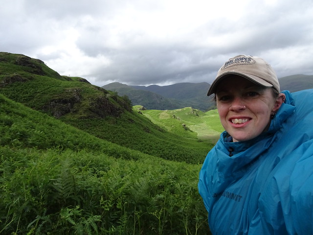
After leaving the train station, and with my pack feeling especially awkward and heavy, we climbed through trees and across farm fields. This would be the norm for the day.
My map book was doing me well until I reached Town End where I took a wrong turn. After chatting with a local and meeting another hiker I got my bearings but managed to leave my hiking poles behind. Along with the power failure in my car I was concerned that this boded badly for what was to come.
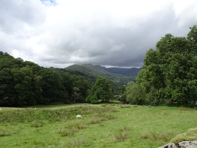
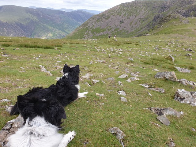
The other hiker I met, whose name was Mike, offered to walk with me and we were both heading for Ambleside. When I realized I had left my poles behind he kindly offered to retrieve them for me. We walked together for a while his legs and lungs far outpacing mine but we enjoyed some conversation, although I was out of breath most of the time as we climbed away from Town End. Views over Windermere were stunning and there were some lovely cows that decided to pose in a lovely way for the camera in top field.
Mike and I parted ways as it was already 2:30 and I needed a lunch break and he was heading on for Ambleside and plotting out the route for guests of the hotel he worked for. The company was nice but again I was reminded of why I prefer to hike alone paces rarely match, and neither do fitness levels.
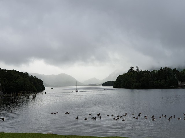
A quick lunch break in Skelghyll Wood was lovely but not quiet as it was a well-used walk out of Ambleside. The view over Windermere from the overlook was lovely but not as good as Id already been given.
We barely touched on the quaint town of Ambleside although it is well worth a visit as it was a town we had driven through and is the epitome of old English village charm. Sadly it is now a tourist draw but it is still a beautiful place to visit.
South of Ambleside we crossed the busy main road, taking our lives into our hands with some pretty chicken-worthy traffic dodging, and followed the river and a minor road north for half a mile.
Another climb assailed us. I was starting to really feel the weight of my pack at the this time and something wasnt feeling quite right. I put it down to not having carried any serious weight since my two days on the South Downs Way in October 2019 more than eight months prior.
We passed a couple of farms, waved to a gentleman on the balcony of his house who was watching walkers and cyclists. And not long after we turned off onto a bridleway. As we passed through the gate I watched a helicopter take off from a not-too-distant location in what I can only assume was a mountain rescue. Within minutes of the departure of the helicopter Cody was almost run over by a speeding cyclist. These trails are shared by hikers, horse riders and cyclists alike but I witnessed numerous moments of high cycle speed on steel downhill slopes with sharp corners almost contributing to accidents.
With Codys brush with cycle tires out of the way we paused for a snack break on the first piece of open access land we had come to. (Open Access land in the UK means you are not restricted to designated footpaths, bridleways and rights of way). Views that I knew would only get better as the days went on.
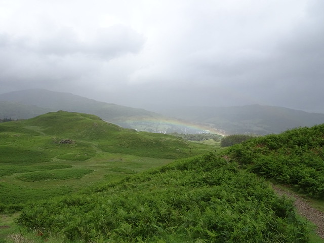
It was just after this very serene moment and lovely break that I made a very irritating navigational error. Granted I was following the map, but the trails werent obviously signposted and there was a lot of confusion with paths. I started climbing but this was when the rain came in rain that wasnt supposed to show until 6pm another two hours away.
So I inadvertently climbed what I believed was Ivy Crag. I talked to a family at the top who appeared to be locals who mentioned that a green strip just below us was a path down. It wasnt. Upon checking the route it was nothing but boggy ground and led to a very steep, rocky, cliffy-like way down. I back-tracked.
The rain had cleared before I reached the top and I was rewarded with the sight of a beautiful rainbow in front of the fells. Sadly it was not to last and the brief rain shower was a portent of what was to come.
By the time I got back to the turn-off and the right path I was getting tired. I was struggling with my pack and couldnt quite understand why the weight wasnt carrying centered. I put it down to the fact that I had drunk more water from the right side than the left.
By the time we reached Loughrigg Tarn the rain was starting up again. We had barely crossed a sheep field when it intensified. I ducked into the trees to don my waterproof pants to go with my waterproof jacket AND a poncho. While I wanted to wait for it to die down I had a feeling it would be a while. I dont mind a little rain but when it is constant and incessant it is really demoralizing.
From Loughrigg Tarn we passed through a caravan park before crossing Skelwith Beck and passing Skelwith Force. We didnt stop at the waterfall as there was zero protection to keep the dogs away from the edge and it wasnt worth the risk. There were also people already on the rocks and Im not good with intruding on gatherings.
The rain continued off and on as we hiked a lovely stretch of bridleway through the woods. Half way through a field of cow the rain hit with a vengeance and made looking at the map very difficult and I kept doubting what Id already checked. I was wet and tired and hadnt really eaten much lunch had been a very small affair. My energy was lagging and my attitude was not a good one.
On top of fighting the weather I was also fed up of dealing with gates that really didnt accommodate anyone with a larger backpack, not to mention the stiles and gates in stone walls the dogs couldnt get through or over and it took my minimal reserves of energy just to get them over these hurdles manually. Thirty-forty pounds of dog, plus their packs was no small weight when I was already struggling.
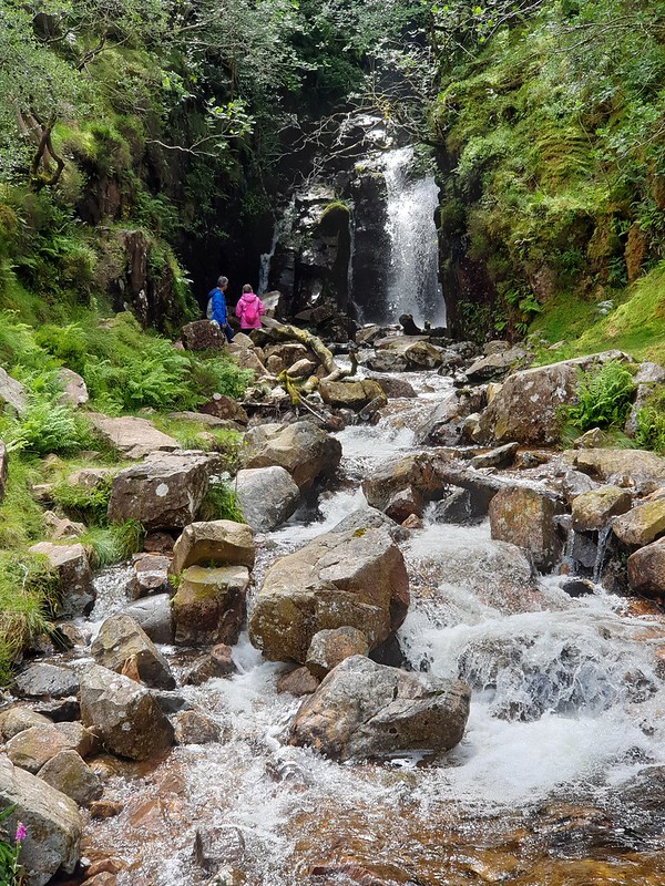
Finally with all the fields and torturous hiker-gates behind us we climbed yet another hill although the rain had now paused for a short while. I was pleasantly surprised by the appearance of Colwith Force which I had forgotten I had routed us past. With all the rain in previous days it was quite the dramatic waterfall.
The woodland dumped us out into more farm fields and then onto a restricted byway where I made another navigational error. I was already running on fumes and was really struggling by this point. Thankfully the error was only across a level trail and we didnt get beyond the next gate before correcting it.
At this time I was fed up. My pack was causing some serious issues with my shoulder and after taking a closer look at it I realized the frame was crooked. This was the same pack in the same configuration I had used the previous year with no issues but I knew something wasnt right. At least I knew my fatigue wasnt just due to lack of calories and the weather.
I was ready to find a camping spot but the place I thought about camping for the night was either covered in bracken or a swamp of bog. I decided on my back-up plan and made the steep but short climb to Cathedral Cave, an old quarry tunnel and cavern that was meant to be beautiful. But my back-up plan was thwarted as the cave was closed due to a rock fall at the far end.
I was now feeling really defeated. I looked at the map and hoped there might be another camping possibility further down the trail. I sent mom my InReach check-in message as it was already 8pm even though I wasnt in camp. When we stood to leave Cody was struggling with his hind-leg not working right; he was almost carrying it as though it was dislocated although he had done nothing to it. It was at that time a combination of unexpected bad weather, Cody looking hurt and my pack causing major issues that I decided to call it and bail on the trip temporarily.
I called Dave for a pick up and returned back to Keswick where I replanned my whole week to keep Cody healthy and still able to hike.
***
Day 2-3 Scale Force, Red Pike, High Stile and High Crag, plus Side Pike
I wasnt about to waste a week of hiking in the Lake District. After looking at my book, a few maps and remembering my friend Abbie Barnes had done Scale Force on one of her videos I decided to incorporate that into a longer hike.
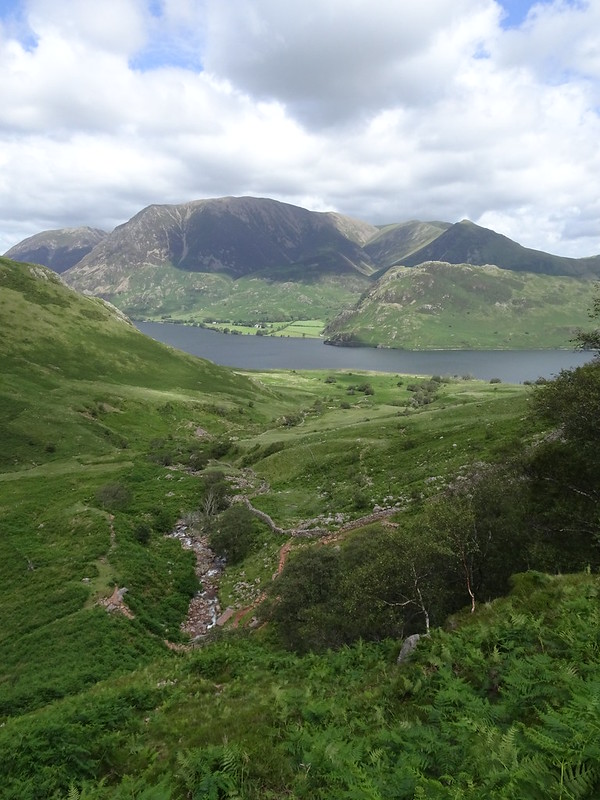
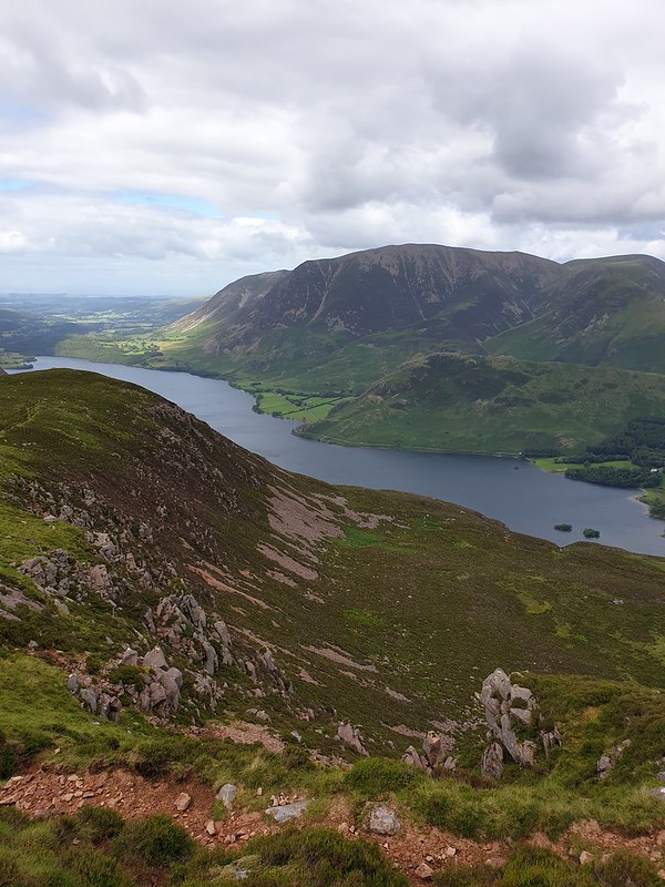
A steep climb from Keswick, over Honister Pass, dropped me into Buttermere where I parked at The Fish Inn for convenience. There were a few other walkers out but most seemed to be visiting Sour Milk Gill waterfall and walking around Buttermere. A few hardier souls were following the path to the right along Crummock Water.
Cody was looking good for not walking well yesterday I swear he malingers sometimes to get out of long walks. A short two miles saw us following the western bank of the lake before we crossed Scale Beck and began climbing up the valley. The path was easy to find and generally easy to navigate although there were certainly some boggy bits and a bit of rock hopping required.
The short steep climb up to Scale Force was a good one and dropped us out just above the beck. A bridge that crossed the creek provided me with amazing initial views of the massive waterfall; it was quite awe-inspiring and made me feel quite small below its raw power.
Scale Force sits back in a carved hollow. The wide and deep waterfall in the lower section is preceded by a long elegant drop of white cascading water that was reminiscent of a horses tail. The amount of rain the Lake District had had recently meant that the waterfalls were pretty spectacular and dramatic although there is something to be said for the lower water flows in dry seasons I often find them prettier and more unique.
From Scale Force we climbed up the right side of the gully. This was the proper footpath marked on the map but it turned out to be a very steep and overgrown trail. Most people seemed to be climbing on the left side of Scale Force which I only realized too late. Climbing on the right meant I missed out on some views of the waterfall and meant a wet crossing of the creek further up the valley. Cody struggled to cross and in aiding him I got a very wet foot and almost lost a hiking pole.
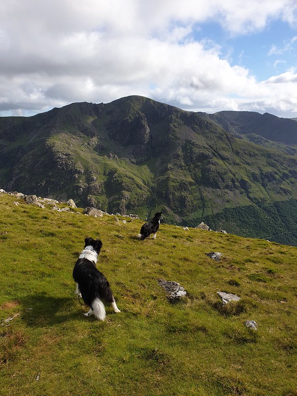
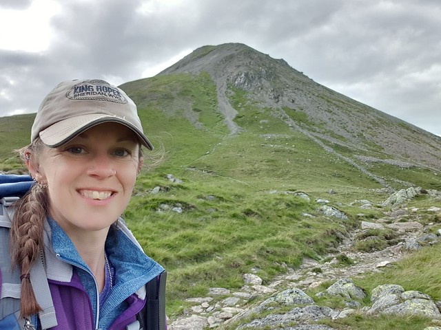
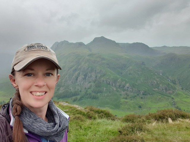
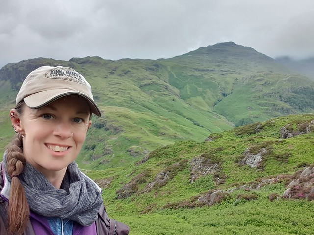
The climb continued in moderation and felt quite long. I was starting to wonder if we would ever reach the top when Red Pike came into view over the wide flat top of the rise. It looked massive and despite how much we had already climbed it looked twice as hard. But on we went and despite my misgivings the ascent wasnt bad. The views, which I struggled to find words for, were spectacular. We looked down over the valley and Buttermere Lake and Crummock Water, and across the valley to Whiteless Pike and beyond to Keswick.
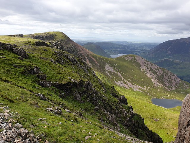
From Red Pike we dropped down slightly before following the edge of the cliff (not quite the edge) round to High Stile. The views of the cliffs ahead, and of the peak before us, were quite different to those approaching Red Pike. High Stile had a very unique profile and a great approach and as we walked between the two Wainwrights we looked down over Bleaberry Tarn and some very steep-looking trails back to the valley.
The views from High Stile werent hugely different from Red Pike but we had a better viewpoint for Ennerdale Valley which people often speak fondly about. We headed towards what I thought was High Crag but I couldnt see how there would be a good way down. I checked my phone for the map and realized we had missed the turn for High Crag.
Thankfully we hadnt missed the path by much and instead of backtracking we crossed the top of the ridge. We met up with the path as it dropped down to a narrow ridge-line towards High Crag. The sun and partially cloudy sky made for some stunning photography opportunities, and the landscape certainly helped.
I was still feeling good at this time right up until we started the brutal descent down the scree-field trail to Seat. The trail switchbacks helped a little but the footing in many spots was quite treacherous I was amazed that the two guys in front of me were managing it with big packs and without hiking poles.
Finally at the bottom with jelly legs shaking quite visibily we climbed the last little mount to Seat before meeting up with the trail that came down from Haystacks. If I was thinking that a trail up to a popular Wainwright would be smooth and easy I was about to be proven wrong. Rough, bouldery, rocky and not very pleasant those were the words I would use to describe it. Of course it may have been those things only because I had already done the previous scary and jelly-leg inducing descent.
I finally reached the base, and the head of Buttermere. Despite it being a tough descent, looking back I was very glad I hadnt had to climb that route with gravity against me. Doing the route counter-clockwise had definitely been the right choice.
The last mile along the banks of Buttermere felt really long and since it was 8pm I was ready to be back at the car. I was envisioning mac and cheese for dinner.
From Buttermere we headed back to Honister Pass where we found a quiet pull-out for the night. I made the mac and cheese but the replacement cheese (Jarlsburg vs goats cheese) I used but was not conducive to melting well and the meal I had been looking forward to wasnt as good as hoped.
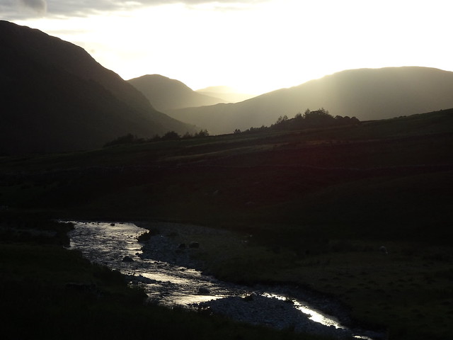
Honister Pass ended up being a great, quiet spot for the night and we were rewarded with part of an epic sunset over the peaks.
You can see the epic footage of the hike here: Be kind this was my first YouTube attempt.
***
The following day didnt have the greatest forecast and Cody was looking quite stiff and I was feeling much the same due to the descent from High Crag. Initially I spent the first part of the morning driving around looking for toilets and eventually had to resort to a porta-potty beside the road that was actually pretty clean.
A drive up to Blea Tarn, and a break in the weather, gave us the opportunity to do the only hike of the day. We did a short but steep climb to the top of Side Pike, a sister summit to Lingmoor Fell. I was a little disappointed to learn this peak wasnt actually a Wainwright, especially considering some of the other random flat mountains of zero note that are considered to be Wainwrights I need to step back in time and have a chat with this gentleman. The climb up required some rock scrambling which Kye did with ease but Cody needed a boost up some of them.
The views over the Langdale Peaks to the north, and the valley below were pretty spectacular in spite of, or maybe because of the weather. We made it back to the car just as the rain began to come in again. With the weather as good an excuse as any we drove down to Little Langdale and enjoyed a pint of beer and some cheesy chips (the big English-style kind) in the lovely Old Dungeon Ghyll pub. Sadly what could have been a lovely charming olde-worlde pub felt sad with all the virus protection measures in place. Despite this it was still a lovely pub that I hope to visit another day.
Two days and three Wainwrights bagged, and one extra peak
Come follow me....please: https://wilderhopewyn.wordpress.com/...the-beginning/
- Home
- Forum
- Journals
- Gallery
- What's New?
- Todays Posts
- 2,000 Miler Listing
-
Odd & Ends
- About WhiteBlaze/Tools
- About WhiteBlaze
- WhiteBlaze user agreement
- WhiteBlaze logo progression
- WhiteBlaze screen savers
- Purchase a banner spot
- Quick reference
- Usercp
- Subscribed Threads
- Members List
- Calendar
- Mark all forums read


 Reply With Quote


