


 Description for A. T. Crossing At Little Antietam Creek, Md, 06/06/09

Description by Irish Eddy

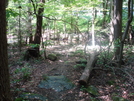
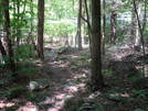
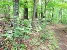
For northbounders, from the east slope of Buzzard Knob, the A.T. begins a 300 foot descent from approximately 1350 feet elevation to approximately 1050 feet elevation at Raven Rock Hollow. This is a view of the A.T. looking north from a location approximately 0.1 mile south Raven Rock Road, MD. Little Antietam Creek can be seen in the center and the guard rail on the south side of Raven Rock Road can be seen in the upper right. SoBo 1129.9. NoBo 1048.4.


Comments for A. T. Crossing At Little Antietam Creek, Md, 06/06/09 (0)