


 Description for A. T. North Of Deer Lick Run, P A, 01/16/10

Description by Irish Eddy

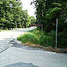
For approximately 1.1 miles north of the pipeline crossing, the A.T. makes a gradual descent from approximately 1470 feet elevation to less than 900 feet elevation as it approachs the Antietam Creek East Branch. This is view from the A.T. looking north from a location approximately 0.5 mile north of the pipeline crossing. Shriners Knob and Briar Mountain can be seen in the distance. SoBo 1117.6 NoBo 1061.5.


Comments for A. T. North Of Deer Lick Run, P A, 01/16/10 (0)