WhiteBlaze Pages 2024
A Complete Appalachian Trail Guidebook.
AVAILABLE NOW. $4 for interactive PDF(smartphone version)
Read more here WhiteBlaze Pages Store

Page 1 of 2 1 2 LastLast
Results 1 to 20 of 27
  1. #1
    Registered User Cadenza's Avatar
    Join Date
    05-11-2012
    Location
    Tellico Plains, TN
    Posts
    291
    Images
    29

    Default Dance of the Sugar Plum Fairy


    Last week I took a big, heavy Mystery Ranch NICE 6500 pack. I loaded it to the gills with everything I like to have. Saw, hatchet, Slinglight chair, white gas stove, etc. I also carried great but heavy food (steak, potatoes, cooking oil, bacon, eggs, etc.). The food load alone made the pack burdensome. On that trip I hated the short hike, but I loved the camping.

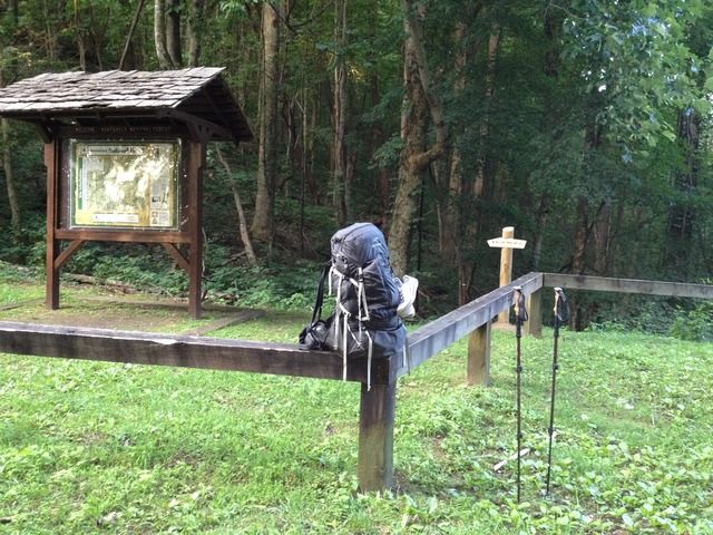
    On Tuesday, I hit the trail again from the same location at Big Fat Gap. This time I carried the Arc’teryx Altra 65 loaded out at 26 lbs. total!
    I carried only the basics. Hammock, cuben fiber tarp, top quilt, a small pot for boiling water, hyper flow water filter, canister stove, rain gear, fire starter, tooth brush and toilet paper. My only food was homemade dehydrated chili and fiber bars.


    I went with the idea that I was going to climb the Slickrock Creek trail to Naked Ground. I had a singular focus.
    Arriving at Big Fat at midnight, I elected to sleep in the car until daylight. I woke up at 7:00 AM and was ready to hit the trail at 7:50.
    Taking a brisk downhill pace with the lightweight pack I easily sailed down the Big Fat Gap trail to Slickrock Creek. The wood thrush was singing his morning song. I arrived at Slickrock Creek by 9:00 AM.
    I took a break for half an hour. I debated about spending the night at the campsite I call "Bass Solo,” but was eager to put trail miles behind me. I elected to push on up Slickrock Creek.

    A few years ago my buddy and I had done this trail coming DOWN. There was another campsite on up the creek we had named “Stop Time.” It got that name because when we had descended we started from Bob Bald, down through Naked Ground, and onto the Slickrock Creek trail. By the time we reached the first campsite we came to we were ready to stop. I had remembered it being much lower and closer to camp Bass Solo than it turned out to be when climbing. My recollection was off. BY A LOT!
    Thinking I could reach Stop Time in about an hour I hit the trail.

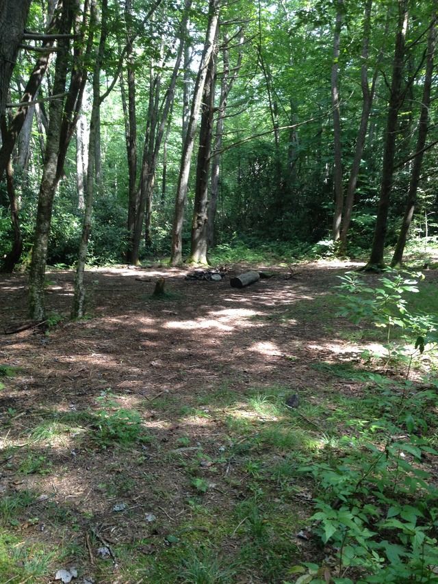
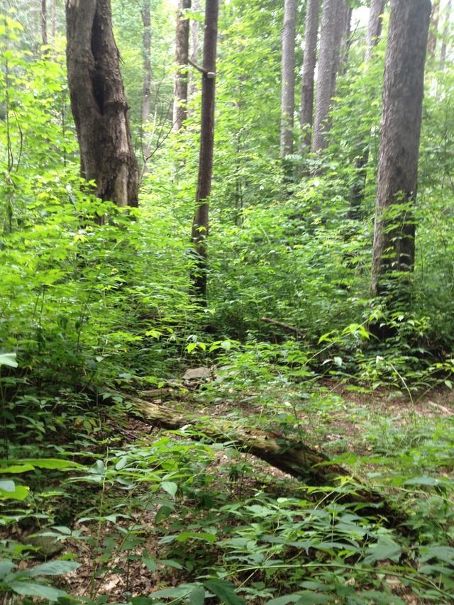
    There was a point where the trail crossed what I believe to be, Hangover Creek. I missed it at first. The trail appeared to continue straight ahead and I discovered another campsite I had not seen before. Beyond this spot, the trail became indistinct and I wasted a good hour trying to find the trail. While wandering about I stirred up a bunch of Yellow Jackets, those ground dwelling bees/wasps with the nasty disposition. They stung me three times on the left elbow and arm, and once right through my pants on my left buttock. It did look like a nice campsite to keep in mind for the future.


    I decided to go back and try to find the trail. It’s funny how seeing things from the other direction can all of a sudden seem so clear. I immediately recognized that the trail actually crossed this small branch. It wasn’t really much of a creek and could be crossed dry shod without having to switch shoes. Once across, there was a short climb and I came upon yet another campsite.


    Just past this campsite, I could see a tent back in a cove behind the foliage. I only caught a glimpse. It was grey and looked as though it might be a cuben fiber tent similar to Zpacks.
    I assumed the trail was going to wind around to it but I never saw it again. Apparently, whoever was camped there had bushwhacked off trail and was trying to remain unseen. I kept pushing on up the trail.
    I had already gone longer than I had expected to reach Stop Time camp.

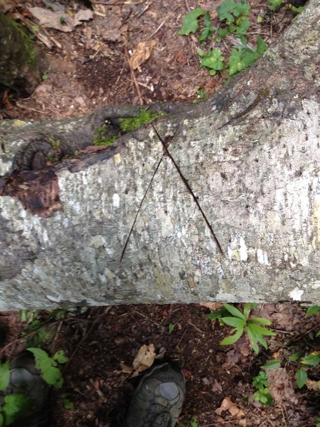
    Along the way, I came upon, and immediately recognized, the downed Hemlock trunk where Tipi Walter had encountered the timber rattler on his trip last month.
    The snake was gone of course, but it struck me funny that I would recognize the same tree.


    Quote Originally Posted by Tipi Walter View Post


    I could see evidence of Tipi’s handiwork all along the trail.


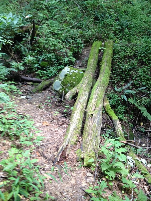
    When I reached this double log bridge I remembered it from my previous trip down this trail. I got excited because I believed Stop Time was going to be just around the bend and not far at all.
    It turned out to be much farther.


    Eventually, after five hours (from the bottom of Big Fat Gap trail intersection) I reached Stop Time camp. It was all overgrown with weeds.
    This camp sits back off the trail and is hidden. That’s probably why it has become overgrown.


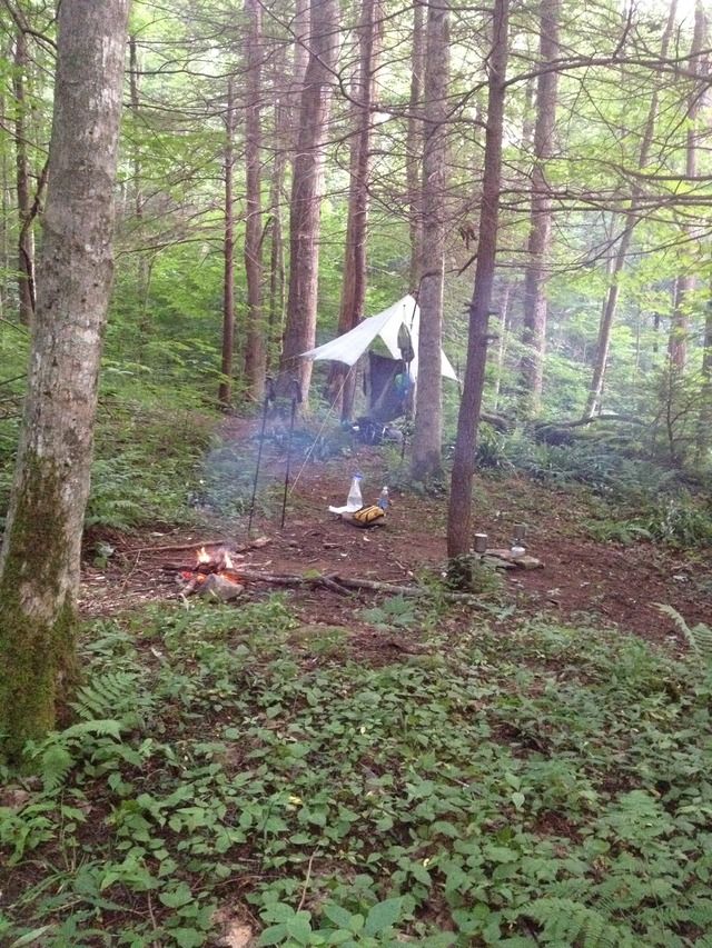
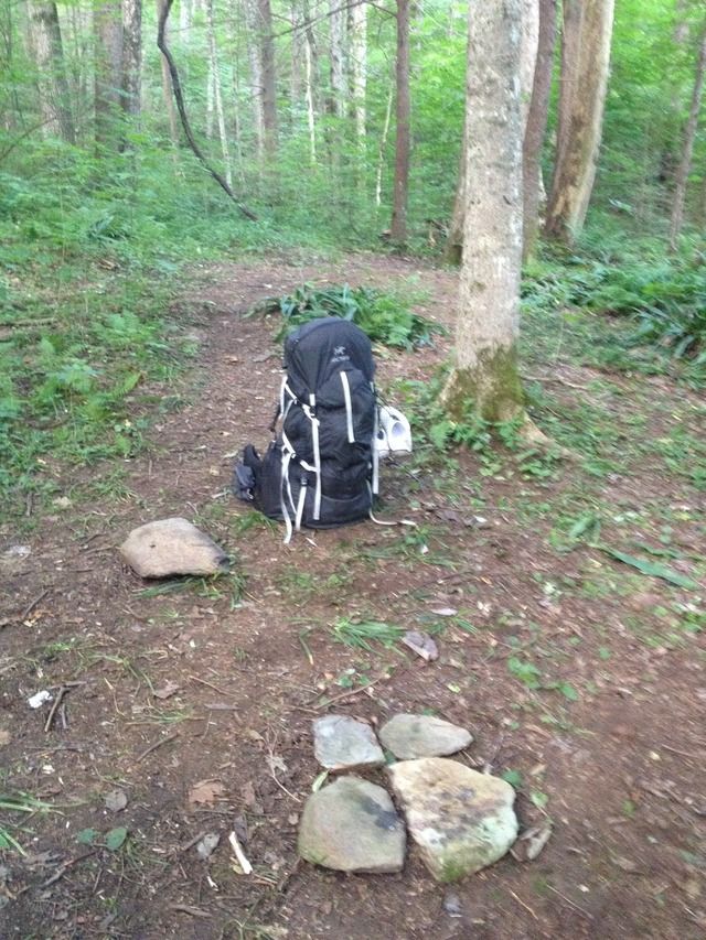
    I elected to string up my hammock right there beside the trail in front of the Stop Time campsite.


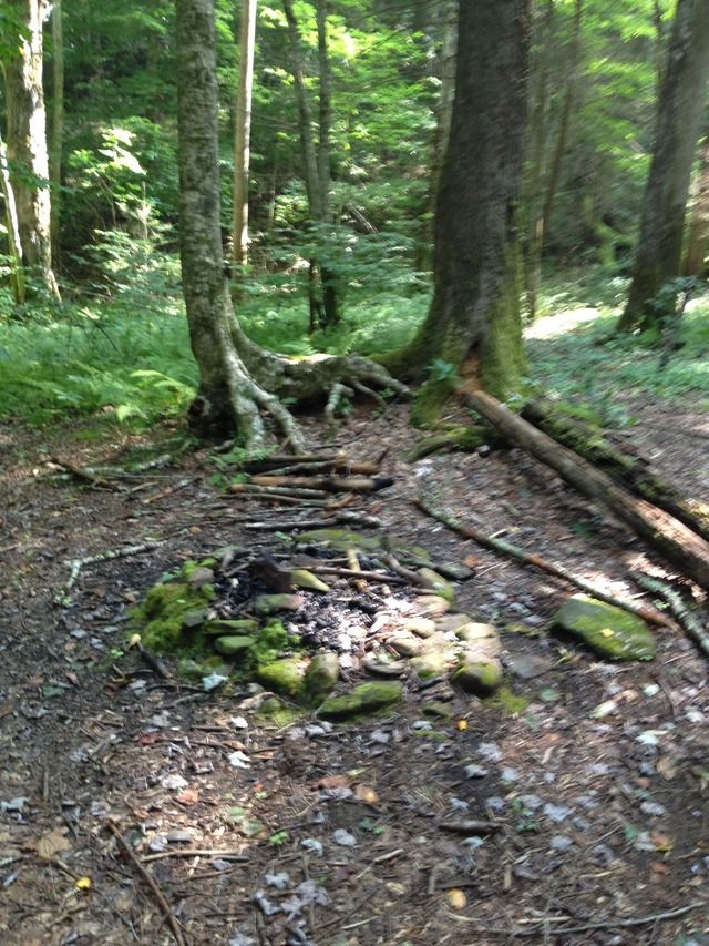
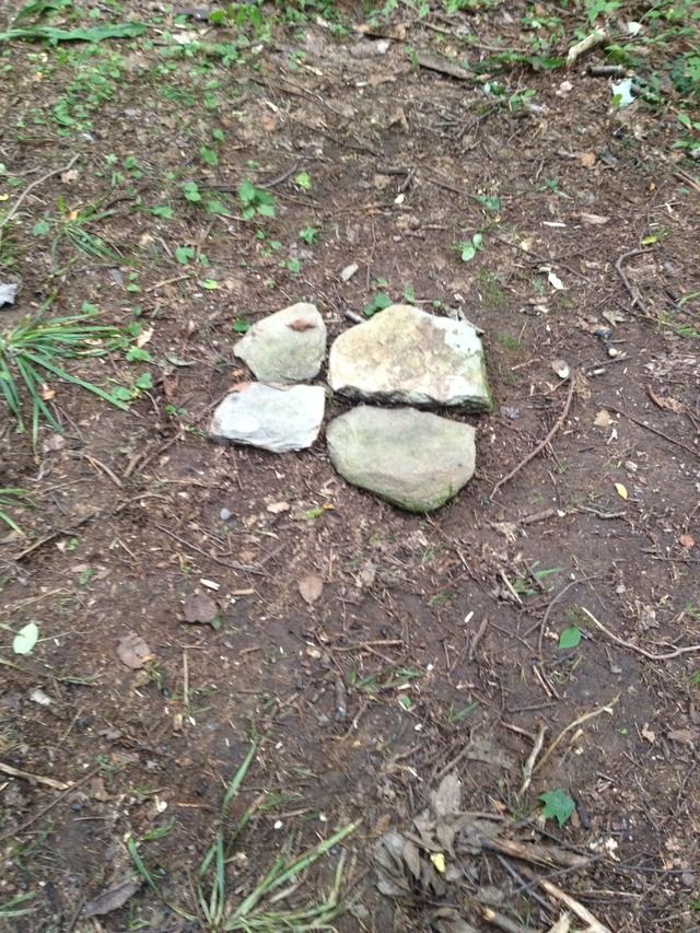
    It’s weird how you see certain things and remember them from a trip 3 or 4 years ago. I saw these four rocks obviously configured on the ground. They had been there, exactly the way I found them all that time, undisturbed by anyone else.


    Packed up and ready to push on up to Naked Ground 8:30 AM…..


    Above the Stop Time camp is where the Slickrock Creek trail starts to get tough.
    Tim Holman’s book describes it as a “calf buster.” Tipi Walter has made the trail better known as the nut buster.
    It’s both.
    It is a long, grueling grind. The switchbacks have you going in all directions. You can hike for an hour and a GPS says you are farther away from your destination than you were before.
    As mentioned, there was ample evidence of Tipi’s trail work. There were also sections where more work is needed. There was a section which is badly overgrown with briars.
    Somebody needs to take a Keyser blade to it. “I call it a Keyser blade. Some people call it a sling blade. Mmm, I like me some biscuits and mustard. ‘Ems some good fried potaters.”

    I finally reached Naked Ground at 1:00 PM.
    The buckeye trees were a welcome sight. I stopped for a pack off break. Ate some lunch and got a phone call out to my friend.
    I hadn’t at this point decided exactly what I would do. There was a possibility that I might camp on my way back to Big Fat Gap via the Hangover Lead trail. I slung pack and shoved off again.
    Having just climbed the nut buster my legs were tired, my butt was tired, my feet were sore. But I pushed on.

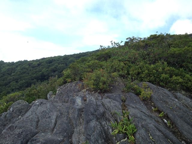
    I had hiked the Hangover Lead before. I remembered it dropping right off the front of the actual Hangover look-out point. Now, there is a new sign indicating Hangover Lead and Benton MacKaye which is back from the actual Hangover. It drops off on the left side of a smaller finger spur, winds around through a laurel thicket, switches back, and eventually ends up on the real Hangover Lead. THIS IS A TERRIBLE SECTION!
    Unless something is done to make it more obvious I’ll predict that a lesser experienced hiker will become lost here. There is a rock outcrop where a misdirected route seems more obvious than the actual trail. It kind of fizzles out and becomes more of a game trail. While trying to negotiate my way through, the trail seemingly had disintegrated, I stopped and said out loud to myself, “There is no way this can be the Benton MacKaye trail!”
    I fought to backtrack. Wasn’t even sure I could follow the path I had taken, but did manage to get back to the rock and find the correct path.


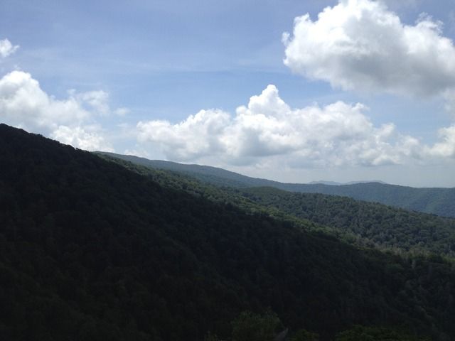
    Looking back toward the Bob.


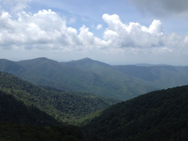
    Looking over at Fodderstack Ridge.


    Tchaikovsky's The Nutcracker hasn’t got anything on the Slickrock Creek trail.
    But having hiked up the nut buster and down the Hangover Lead trails all in one day, it is my opinion that the Hangover Lead is just as tough as the nut buster.
    I have no desire to do either one again soon.
    Last edited by Cadenza; 07-30-2015 at 23:01.

  2. #2
    Registered User
    Join Date
    07-05-2011
    Location
    Gurja
    Posts
    385
    Journal Entries
    1

    Default

    Enjoyed reading about your trip! Thanks for sharing. Love all the names..."Big Fat Gap" especially.

  3. #3
    Registered User
    Join Date
    06-25-2012
    Location
    Lurkerville, East Tn
    Age
    64
    Posts
    3,720
    Journal Entries
    1

    Default

    Nice report Cadenza! Great pictures, too.

  4. #4

    Default

    Once again a cool trip report of known and beloved trails. Yes, even the Nutbuster and the Hangover Lead South trails are neato. And on my last trip I saw a rattlesnake on the Hangover trail down to Big Fat Gap and another one on the Big Fat trail down to Slickrock Creek.


    Here's a pic of the place in your second pic where the Nutbuster trail goes across Hangover Creek but many people veer left and end up on this hill. Behind my tent and down and to the left is the real trail as it crosses the creek etc as you well know.


    There used to be this sign not far above the Hangover Creek crossing but some redneck miscreants took it for their own personal use.


    I have divided the Nut Eater trail into 10 sections from the bottom to the top at Naked Ground. Leg 1 goes to the Hangover Creek Crossing. Leg 2 goes to where the old Ballbuster sign used to be. And Leg 3 stays on a logging road with 3 main switchbacks (and over that "pig bridge" you show on picture 7.

    Thing is, at the end of Leg 3 the trail climbs very steep up and to the right but if you go straight on faint trail you'll cross Hangover Creek again and reach this very private campsite I call Buckeye Camp.


    This pic shows me standing in Buckeye Camp and looking at the Nutbuster trail as it climbs steeply off the logging road and switchbacks to the right on Leg 4.


    Past Buckeye Camp on Leg 4 you reach the Rock Section where the trail passes thru these big rocks. It's nice.


    And your open cove pic with the hammock in pic 8 and 9 is here, at the start of the terrible Open Cove leg where I saw that rattlesnake. This is a good campsite because it's midway up the Nut and has water.

  5. #5

    Default


    This is the once open cove section Leg 5 where I saw the rattlesnake. This used to be the best part of the whole nutbuster trail before all the hemlocks died but then they died and fell and obliterated the trail. This pic shows the trail going right thru this mess. Now it's a briar field and full of weeds and saplings.


    You mentioned the Hangover Lead South trail down to Big Fat Gap as being bad but I just did it and in my opinion it's much easier than the Nutbuster. Here's the part of the Hangover trail where people get lost in the heath tunnel as the trail seems to go straight (when descending) and they don't see the right turn in the ditch. If you do go straight you reach this deadend overlook which is awesome. I call it Table Rock. You're looking at Fodderstack Ridge and Big Fodderstack Mt.


    I remember pulling one winter trip when I left Big Fat Gap on the Hangover Lead South trail and climbed to the Hangover in the snow. It was a rough trip.

    Anyway, thanks Randy for the report and the pics.

  6. #6
    Registered User
    Join Date
    12-19-2005
    Location
    Knoxville, TN
    Posts
    3,715
    Images
    3

    Default

    I thought tipi had posted something earlier about the signs up near hangover being straightened out.....

  7. #7
    Registered User Cadenza's Avatar
    Join Date
    05-11-2012
    Location
    Tellico Plains, TN
    Posts
    291
    Images
    29

    Default

    Yes, there are new signs up near Hangover. They are great looking signs, the best I've ever seen in the area.
    They clearly mark Hangover Lead, the direction to Big Fat trailhead, Haoe Lead, Benton MacKaye, etc.

    I'm serious when I say I think some Benton MacKaye type fast and light hiker will get lost and go missing in the laurel heath section. I could easily envision a storm moving in and catching someone while they are flailing around. There is nowhere to hunker down. Being lost here could be hypothermia and quick peril.
    I have a good sense of direction, know the general orientation, had good weather, was well equipped,....and I lost an hour trying to find the trail.
    Under different conditions, storm moving in, a thru hiker could easily panic and be in big trouble. If we hear of a Benton MacKaye thru hiker being lost I think the rescue teams would be well advised to start looking here.
    Last edited by Cadenza; 07-30-2015 at 11:14.

  8. #8
    Registered User
    Join Date
    12-19-2005
    Location
    Knoxville, TN
    Posts
    3,715
    Images
    3

    Default

    yeah....

    was your trip before or after this picture where tipi says the signs were fixed?


    https://tipiwalter.smugmug.com/Backp...care/i-tsc8sNR

  9. #9
    Registered User Cadenza's Avatar
    Join Date
    05-11-2012
    Location
    Tellico Plains, TN
    Posts
    291
    Images
    29

    Default

    After.
    I just hiked the nut buster and Hangover Lead yesterday. (July 29)

    And woke up tired and sore this morning.


    The signs are nice! My problem wasn't that the signs were wrong. The reroute of the Hangover Lead trail is just confusing.
    Last edited by Cadenza; 07-30-2015 at 22:28.

  10. #10
    Registered User
    Join Date
    07-09-2014
    Location
    Littleton, CO
    Age
    42
    Posts
    203

    Default

    I want to move to TN.

  11. #11

    Default

    Quote Originally Posted by Wülfgang View Post
    I want to move to TN.
    If you like these kind of trails (pictured below), then you'll love backpacking in Tennessee---(Yes, this is the Fodderstack Ridge trail)


  12. #12

    Default

    Quote Originally Posted by Cadenza View Post

    I'm serious when I say I think some Benton MacKaye type fast and light hiker will get lost and go missing in the laurel heath section. I could easily envision a storm moving in and catching someone while they are flailing around. There is nowhere to hunker down. Being lost here could be hypothermia and quick peril.
    I have a good sense of direction, know the general orientation, had good weather, was well equipped,....and I lost an hour trying to find the trail.
    Under different conditions, storm moving in, a thru hiker could easily panic and be in big trouble. If we hear of a Benton MacKaye thru hiker being lost I think the rescue teams would be well advised to start looking here.
    It's funny you should mention this as I was on an October trip back in 2009 and we had terrible conditions with sleet and low October temps. I was camped in Naked Ground Gap and a large group of backpackers came up the Nutbuster trail and camped nearby. The next morning two of their party had enough and wanted to bail down the Hangover Lead South back to their car but they came up the Nutbuster and didn't know jack-squat about the South Lead trail. Oops. Rule #1: Never separate your group!

    Anyway, they left in a cold 35F rain and got to the Hangover and took the Hangover Lead South trail down to Big Fat Gap but got stuck in the heath tunnel where the trail appears to go straight to my Table Rock but really turns right. They went straight and ended up bushwacking down off the ridge in impassable heath.

    Many hours later they stumbled back into Naked Ground after a terrible day and were drenched and cold and shaking and their pvc rain pants were shredded and looked like banana peels hanging off their waists. They begged me to take them out NOW and find THE CLOSEST ROAD and all the rest. I was not going to let their epic become my epic and so I told them to set up camp in Naked Ground and we'd bail off the mountain back to their car in the morning.

    Their gear was soaked and one sleeping bag was drenched so I told them to set up their tents and eventually got both guys in a single tent to conserve heat and double up to stay warm and stay alive until morning.

    The next day I hiked them down and off the Hangover and pointed out the right ditch turn which they missed. The whole story is here---

    http://www.trailjournals.com/entry.cfm?id=293987

    http://www.trailjournals.com/entry.cfm?id=293998


    The big group prepares to shove out of Naked Ground in a cold October rain. Two boys decide to bail out of the group and take an unknown trail off the mountain.


    After their epic they return to Naked Ground and the next day I lead them off the Hangover and down to Big Fat Gap.


    And as Cadenza says, the Hangover Lead South trail is tough but the boys reach Big Fat Gap and "safety". I await with eager anticipation for the same thing to happen to BMT thruhikers coming off the Hangover.

    BTW, when we reached Big Fat Gap the boys offered me ANYTHING! EVERYTHING! I said, "Give me all your meat!!" Not for me as I'm a vegetarian but for my dog Shunka. They gave me every packet of meat they had and Shunka ate like a king.

  13. #13
    Registered User Cadenza's Avatar
    Join Date
    05-11-2012
    Location
    Tellico Plains, TN
    Posts
    291
    Images
    29

    Default

    Quote Originally Posted by Tipi Walter View Post

    BTW, when we reached Big Fat Gap the boys offered me ANYTHING! EVERYTHING! I said, "Give me all your meat!!" Not for me as I'm a vegetarian but for my dog Shunka. They gave me every packet of meat they had and Shunka ate like a king.


    That's funny!

  14. #14

    Default

    And Randy's right, descending Hangover Mt in sketchy conditions will prove to be a problem for some backpackers. Here's a vid I took standing in the heath tunnel on the side of Hangover Mt and it was July and hot, now imagine a snowstorm at 0F.


  15. #15

    Default

    Nice trip report Cadenza, thank you.

  16. #16
    Registered User
    Join Date
    12-19-2005
    Location
    Knoxville, TN
    Posts
    3,715
    Images
    3

    Default

    Quote Originally Posted by Wülfgang View Post
    I want to move to TN.


    do it..........


    ive move here twice mainly for the purpose of hiking and all the outdoor activities...........

    and there are other perks of the area as well-----a job, low cost of living, and if you move to knoxville--a really good used bookstore......

  17. #17
    Registered User
    Join Date
    12-19-2005
    Location
    Knoxville, TN
    Posts
    3,715
    Images
    3

    Default

    Quote Originally Posted by Cadenza View Post
    After. I just hiked the nut buster and Hangover Lead yesterday. (July 29)

    And woke up tired and sore this morning.


    The signs are nice! My problem wasn't that the signs were wrong. The reroute of the Hangover Lead trail is just confusing.


    ahhhhhhhhhhh...................ok.....

    was thinking that in tipi's photos they were fixing the wrong signs....

    i havent been up on the hangover lead trail in a year or so, but yeah, that gap area can get confusing.......

  18. #18
    Registered User
    Join Date
    06-25-2012
    Location
    Lurkerville, East Tn
    Age
    64
    Posts
    3,720
    Journal Entries
    1

    Default

    Quote Originally Posted by TNhiker View Post
    do it..........ive move here twice mainly for the purpose of hiking and all the outdoor activities...........and there are other perks of the area as well-----a job, low cost of living, and if you move to knoxville--a really good used bookstore......
    It is a good bookstore, and I'm lucky to work just a half-mile away!

  19. #19
    Registered User
    Join Date
    07-09-2014
    Location
    Littleton, CO
    Age
    42
    Posts
    203

    Default

    Quote Originally Posted by TNhiker View Post
    do it..........


    ive move here twice mainly for the purpose of hiking and all the outdoor activities...........

    and there are other perks of the area as well-----a job, low cost of living, and if you move to knoxville--a really good used bookstore......
    Believe it or not I'm actually serious. For the reasons you mentioned--low cost of living, longer hiking and growing season, and lots of hiking in the region.

    I love Colorado but 1) The job market here sucks, 2) The cost of housing is OUTRAGEOUS, and 3) The hiking is world-class but the prime season is so short---mid June to mid September, give or take a couple weeks. That and I'm prone to altitude sickness. Go figure.

  20. #20
    Registered User
    Join Date
    12-19-2005
    Location
    Knoxville, TN
    Posts
    3,715
    Images
    3

    Default

    interesting....

    and to think im considering moving to CO......

    tons of great music and legal marijuana..............both works well with me......


    well.........let us know if you need help moving into this area............ive lived here for since 97 and kinda know the lay of the land.....

    and yeah.......we can go hiking in short in january sometimes down here.............

Page 1 of 2 1 2 LastLast
++ New Posts ++

Posting Permissions

  • You may not post new threads
  • You may not post replies
  • You may not post attachments
  • You may not edit your posts
  •